title: "New: Automatically Discover Where Your Vehicles Stop Most" slug: poi-detection-frequent-stops summary: "POI Detection analyzes your vehicles' stop data over 90 days and identifies frequent locations. Get notified as soon as a new point of interest is detected." caption_title: "Your GPS tracker records thousands of stops. You see none of the patterns." caption_body: | A customer asked me: where do my vehicles stop the most? I had all the data. Ignition events, timestamps, coordinates. But no way to surface patterns from the noise. So I built POI Detection: automatic clustering of frequent stop locations. Here's how I designed the algorithm and what I learned.
You know where your vehicles are. But do you know where they stop?
You track your fleet in real time. You see vehicles moving on the map. You get speed alerts, geo-zone notifications. GPS tracking works. But there is a question most fleet managers cannot answer: where do my vehicles spend the most time parked?
This is not a trivial question. Stops are where things happen. Deliveries, client meetings, driver breaks, unauthorized detours. Movement tells you the vehicle is driving. Stops tell you what the driver is actually doing.
Until now, understanding your fleet's stop habits meant either calling drivers or going through trip history one by one. For 3 vehicles, that's manageable. For 15 or 30, it's impossible.
That is why we built POI Detection.
The problem: untapped stop data
Every GPS tracker records thousands of events per month. Ignition on, ignition off, device stopped, device moving. All that data is there, stored in the system. But it is raw. A list of stops with GPS coordinates, timestamps, durations. Without processing, it is noise.
A vehicle stopping for 15 minutes at the same spot every day is a signal. A vehicle regularly stopping in a neighborhood with no client is another signal. But these signals are buried in hundreds of daily stops. No manager has time to search for them manually.
Competitors offer heat maps or stop reports. But a heat map shows you where there is activity, not where there are habits. And a stop report gives you a raw list without context. What is missing is intelligence: grouping nearby stops, identifying recurring locations, and surfacing unusual new places.
How POI Detection works
POI Detection automatically analyzes your vehicles' stop data and identifies the locations where they stop most often. No complicated setup. You enable the feature, and the system does the work.
90-day analysis. The system examines the last 3 months of data. Every stop lasting more than 2 minutes is considered. Short stops (traffic lights, congestion) are automatically filtered out.
Smart clustering. Two stops 50 meters apart are the same place. The system groups all stops within a 100-meter radius and calculates the group's center, weighted by duration. A 2-hour stop counts more than a 5-minute stop when determining the exact center of the point of interest.
Weekly updates. Every week, the system recomputes POIs. New frequent locations are detected. Existing locations are updated with the latest visits. You don't have to do anything. The data updates itself.
Proactive notifications. When the system detects a new point of interest, you receive a notification. By email and by push notification in the app. You are the first to know when a vehicle starts frequenting a new location.
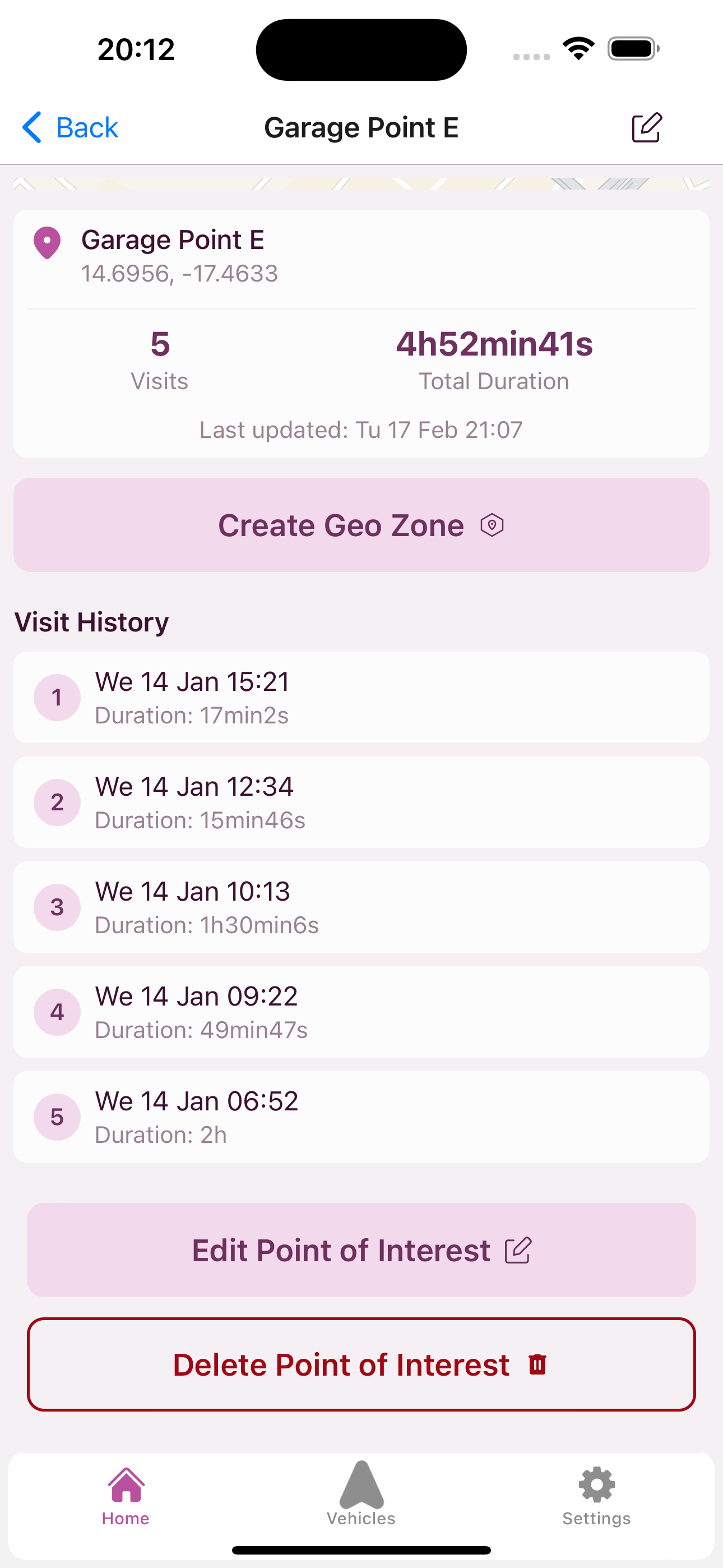
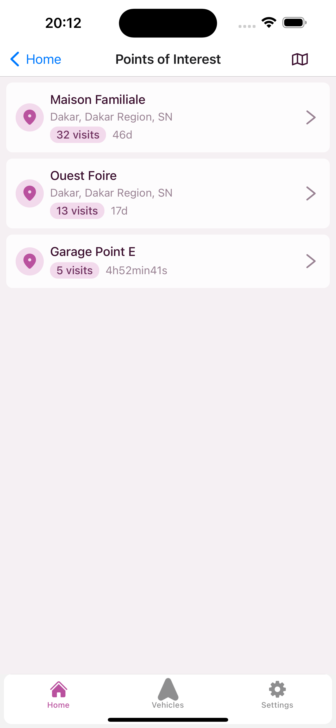
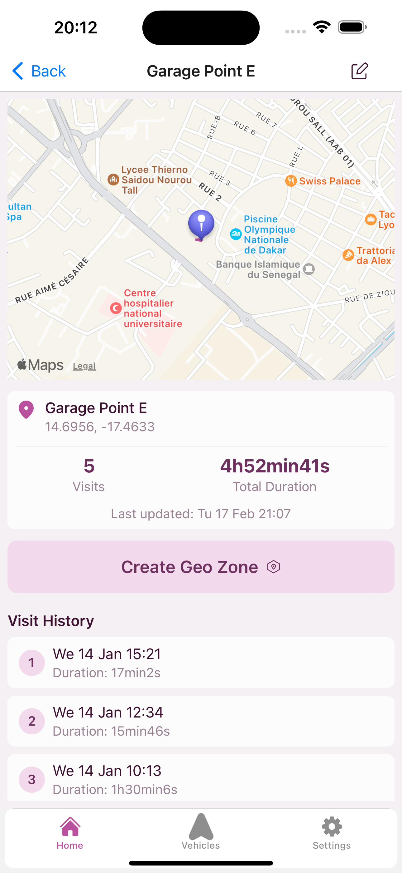
What you see for each POI
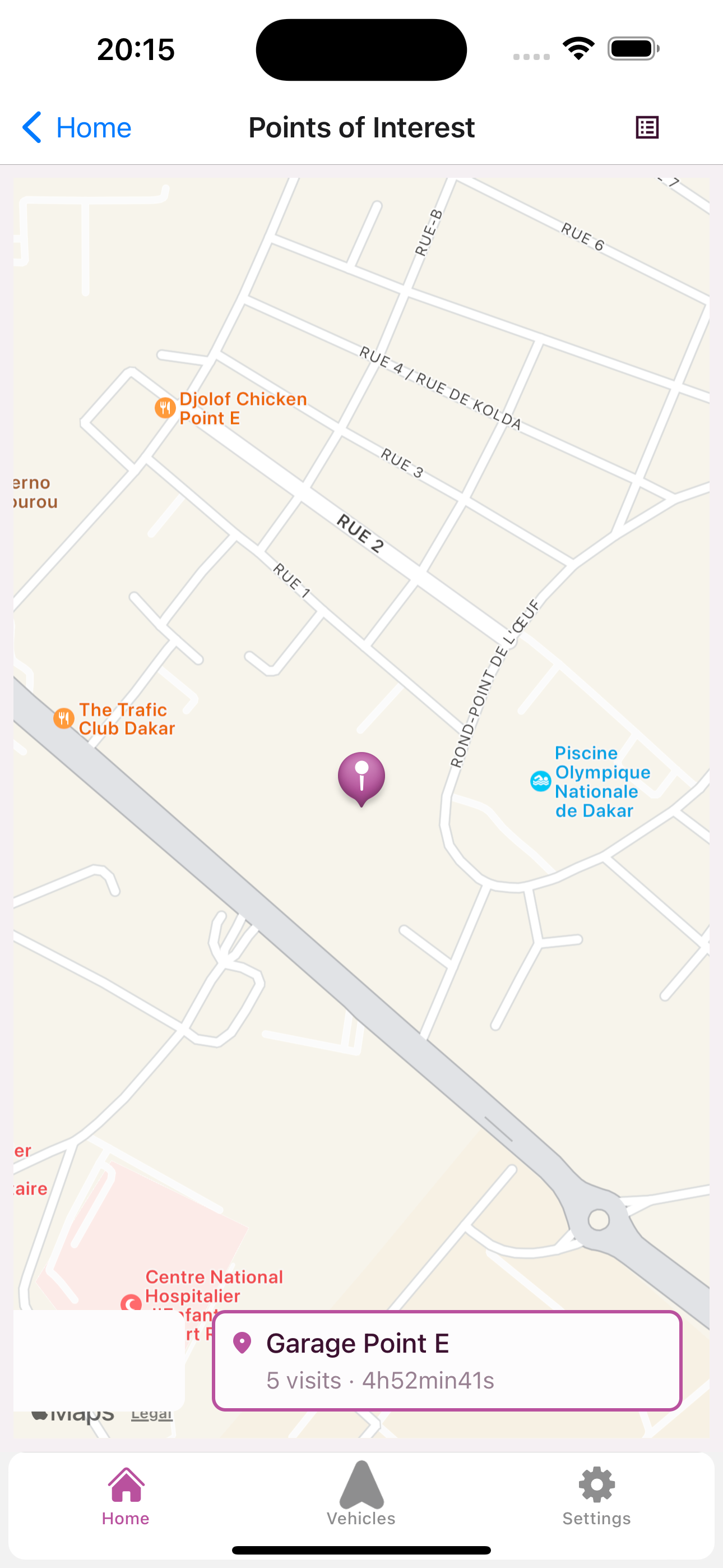
Each point of interest gives you a complete view of activity at that location:
- Location. The address and position on the map.
- Visit count. How many times your vehicles stopped at that spot.
- Total duration. The cumulative time spent at that location.
- Vehicles involved. Which vehicles in your fleet visit this place.
- Visit history. The detailed list of each visit with the date, duration, and vehicle.
This information lets you understand not just where your vehicles stop, but how often, for how long, and with which vehicles.
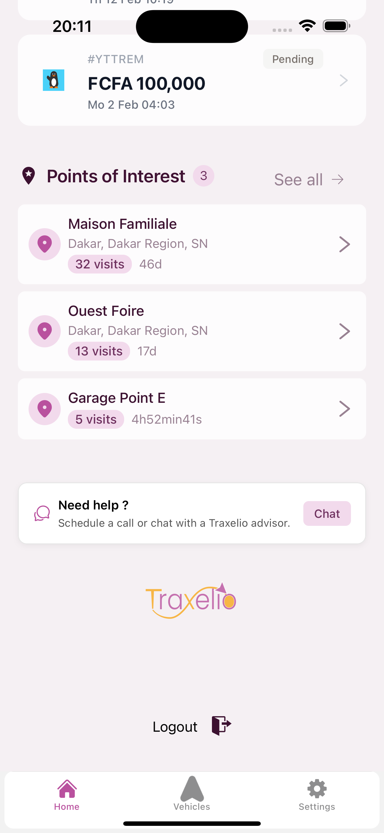
Your most important POIs also appear directly on the home screen, so you can check your fleet's frequent stop locations at a glance without navigating to a separate page.
Fleet-wide team view
Fleet managers who use teams get an even more powerful perspective. The team-level POI view aggregates stop data across all vehicles in the fleet into a single unified list.
- All vehicles, one view. See every frequent stop location across your entire fleet, not just one vehicle at a time.
- Filter by vehicle or date range. Narrow down the view to a specific vehicle or time period to focus on what matters.
- Cross-vehicle insights. The
device_countfield shows how many distinct vehicles visit each location. A POI visited by 8 out of 10 vehicles is likely a depot. A POI visited by only one vehicle might be worth investigating. - Fleet-wide stop patterns. Identify shared client sites, common rest areas, or unexpected stops that multiple drivers frequent.
This is especially useful for logistics companies and rental operators managing 10+ vehicles. Instead of checking each vehicle individually, the team view surfaces patterns that would otherwise stay hidden.
A real-world example
Amadou manages 12 rental vehicles in Dakar. One of his regular clients rents a vehicle monthly. The contract stipulates use within the Dakar region only.
Every month, the client returns the vehicle in good condition. The mileage looks reasonable. Everything seems normal.
Then Amadou enables POI Detection. After the first analysis, the system shows him something unexpected: a frequent point of interest in Thies. 8 visits in one month. Average duration of 3 hours per visit.
The client was not just commuting to work. He was using the vehicle for business trips to Thies, which was not covered by the contract.
Amadou did not need to monitor the vehicle in real time every day. He did not need to comb through trip reports. The system surfaced the information automatically. He can now discuss with the client to adjust the terms or pricing.
Who POI Detection is for
Car rental operators. Verify that clients use vehicles as agreed. Detect frequent stops in unauthorized areas. Identify regular parking locations to assess wear and risk.
Logistics fleet managers. Understand delivery habits. Identify frequent drop-off points to optimize routes. Detect unplanned detours.
VTC and transport operators. Analyze the most frequent pickup zones. Identify neighborhoods where your vehicles spend the most time waiting. Optimize fleet positioning.
Individual owners. Keep an eye on how your vehicle is used. Verify that the driver follows planned routes. Get alerted when a new frequent stop location appears.
How to enable POI Detection
POI Detection is available to all Premium and Platinum subscribers at no extra cost.
- Open the Traxelio app.
- Go to your vehicle's settings.
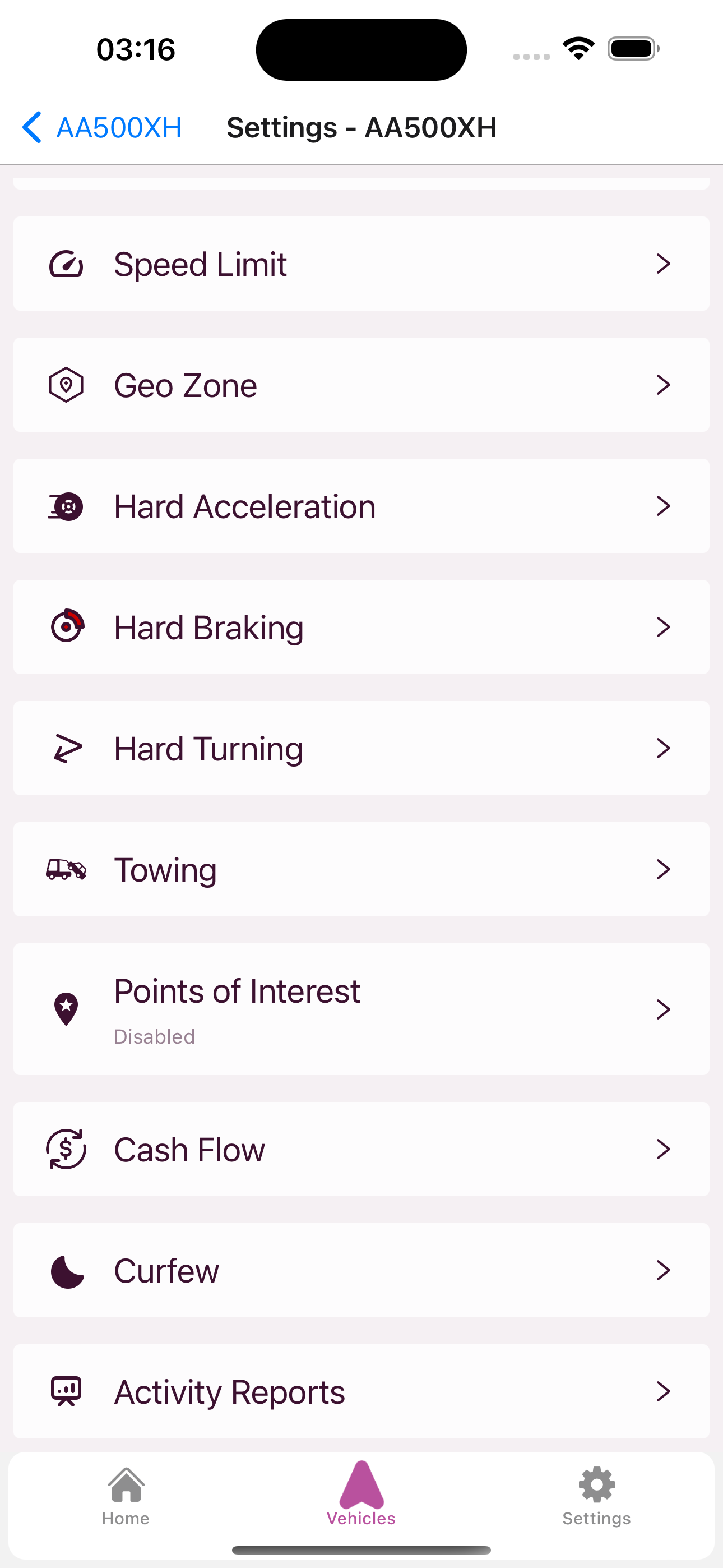
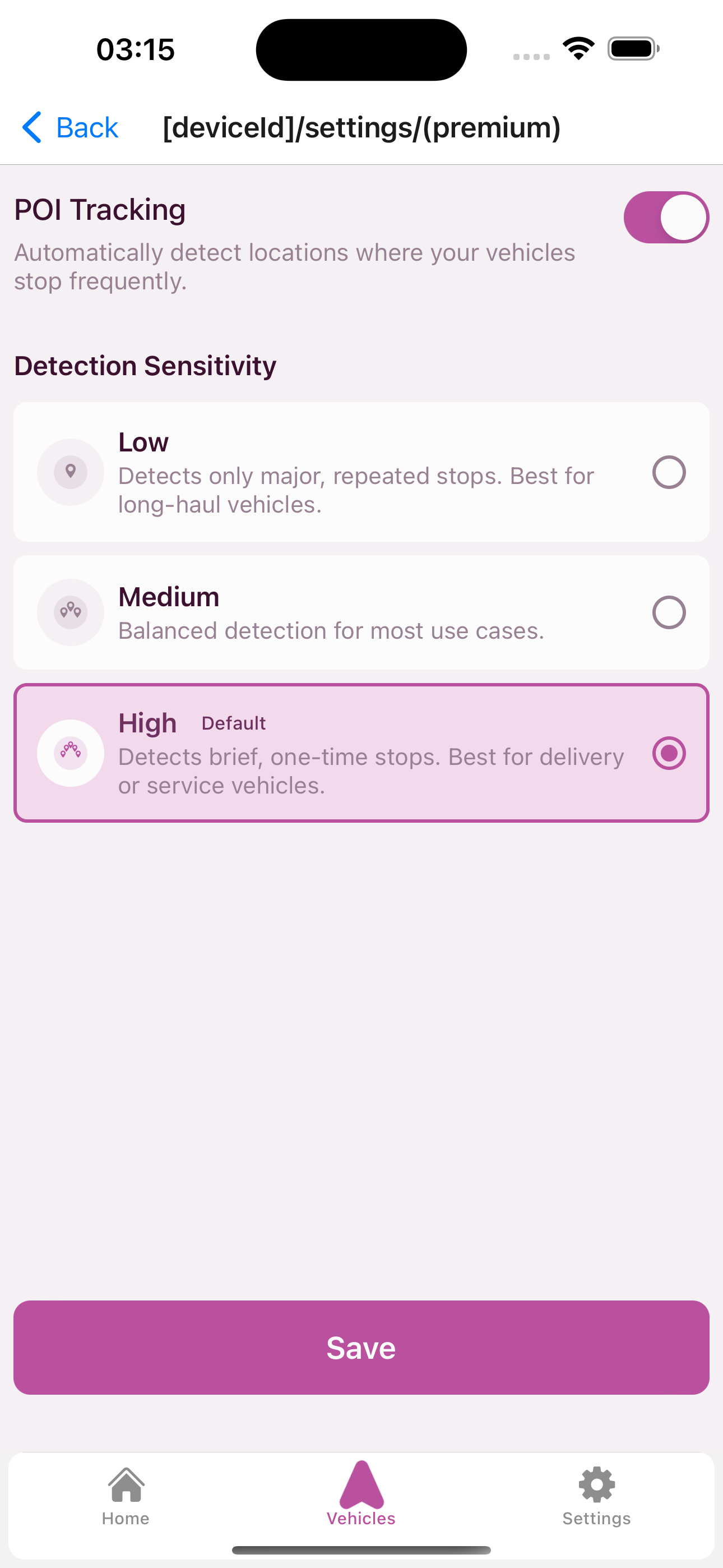
- Tap "Points of Interest" and enable POI Tracking.
- Choose your detection sensitivity: Low for long-haul vehicles, Medium for balanced detection, or High for delivery and service vehicles that make frequent short stops.
- The system starts analyzing automatically.
Your first points of interest will appear at the next weekly analysis. From then on, you will receive a notification whenever a new frequent location is detected.
Your vehicles stop somewhere every day. The question is: do you know where?
Enable POI Detection: traxelio.com
